On our way home from the long weekend in Osoyoos, we made the effort to finally stop at the viewpoint for The Hope Slide. This would mark about the 6th or 8th time that I’ve gone passed it, so we finally followed through on the thought of stopping to get out and take a first hand look at this incredible, natural disaster.
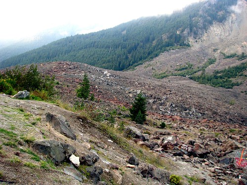
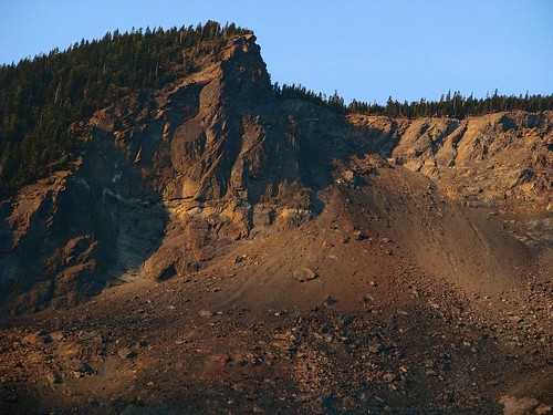
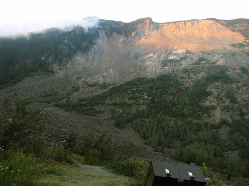
It’s such an impressive sight when you first lay eyes on this scarred side of a mountain. It gets even more confounding when you get more of the details behind this event that happened 43 years ago.
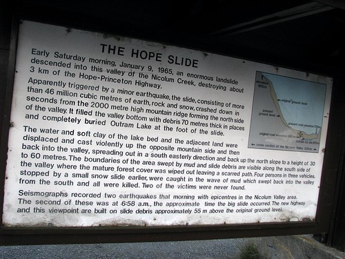
The Hope Slide was one of the largest landslides ever recorded in Canada. It occurred in the morning hours of 9 January 1965. An earlier, small avalanche had forced four people to stop their vehicles a few miles southeast of the town of Hope, British Columbia (150 km east of Vancouver), on a stretch of the Hope-Princeton Highway below Johnson Peak. As those people contemplated waiting for clearing crews or turning around, a small earthquake below the mountain triggered the main slide, which obliterated the mountain’s southwestern slope.
The slide buried the victims and their vehicles under a torrent of 46 million cubic meters of pulverized rock, mud, and debris 85 m thick and 3 km wide, which came down the 2000-metre mountainside . This mass of debris completely displaced the lake below with incredible force, throwing it against the opposite side of the valley, wiping all vegetation and trees down to the bare rock, then ‘splashed back’ up the original (now bare) slope before settling. […]
Rescue crews only found two of the four bodies—the others have remained entombed in the rock, with their cars, since 1965. [wiki]

Mother nature is forever unpredictable. Awe inspiring and frightening, all at the same time.