
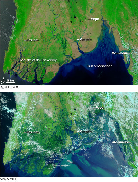
What follows below is a before and after shot from space of the area that was devastated by Cyclone Nargis in Myanmar about three weeks ago. The first photo is from April 15, 2008, and the second photo was taken on May 5, 2008, just a matter of days after the cyclone slammed into the country. Credit to Paul Kedrosky who created this image from NASA satellite photos.
I simply found this image shocking. The thing is, conditions are not that much better for a lot of people in the area, but help is slowly getting into the country. The military controlled government is making the overall situation tough in terms of allowing foreign aid into the country, and the same can be said about letting much information out of the country for the rest of the world to really get a sense of the conditions there.
I did a bit of searching and the best thing I could come up was the redcross.org website that is probably having the most success in getting relief to the area. You can find out more on their website here as well as a way to help donate to the effort.
New Orleans without the dikes.
It is so unfortunate the Burmese government (don’t placate them with the use of Myanmar) has closed the door on help. By contrast, the Chinese have opened the door for help and you can see the differences in response.
It begs the question…how many people REALLY died in the tsunami? Burma was very quiet about what happened there by contrast to Indonesia, Thailand and The Maldives.
Great pics…thanks for posting.